

Maple Leaf – Royal Roads
Maple Leaf – Royal Roads

In 1906 James Dunsmuir commissioned Canadian architect Samuel Maclure to build a 40-room mansion on their estate “Hatley Park”. The building is 200 feet long and 86 feet wide; the turret is 82 feet high. Local stone, and sandstone from Valdez and Saturna Island was used in the building’s construction. The castle was completed in 1908.

After Dunsmuir died in May 1920, wife lived on at Hatley Park with her daughter Eleanor until she died in August, 1937. Eleanor died six months later.
For the next three years, the estate was left in the hands of a caretaker. In November 1940, it was purchased by the Dominion Government for $75,000 to begin its career as a Naval Training Establishment. On 13 December 1940 HMCS Royal Roads was commissioned as an Officer Training Establishment for short-term probationary RCNVR sub-lieutenants and operated as such until 21 October 1942, when the facility was renamed to the Royal Canadian Naval College at Royal Roads and training of regular force naval cadets commenced.
At the outbreak of World War II the federal Crown-in-Council developed contingency plans for Hatley Castle to be uses as the King’s royal residence. The Royal Family and government decided against the Royal Family leaving the UK during the war, and King George VI, Queen Elizabeth, and princesses Elizabeth and Margaret,stayed in London.

In 1945 the facility became the Royal Canadian Naval College became, in 1947, the RCN-RCAF Joint Services College. In 1948 army cadets were admitted and Royal Roads became a tri-service College known as the Canadian Services College Royal Roads. In 1968, the name of the College was changed to Royal Roads Military College

The military college was closed in 1995 and Royal Roads University was opened as a public, degree-granting university. It leases the campus from the Department of National Defence for $1 per year.

In 1995 the castle and grounds were designated as Hatley Park National Historic Site. Royal Roads University is responsible for site management, operations, heritage preservation and restoration, and educating the public about the site’s history and natural resources.

Royal Roads is named for the Royal Roads body of water, which forms the entrance into Esquimalt Harbour from the Strait of Juan de Fuca, lying to the east.

The museum underneath Hatley Castle at Royal Roads

Seals and sealions basking in the sun on the breakwater at Fanny Bay – this sheltered section of Baynes Sound is between highway 19A and Denman Island.


Named after Colonel W. Grant Morden, one of the chief financiers of the mine, excavation of two parallel shafts for the Pacific Coast Coal Mines (PCCM) Morden mine commenced in March 1912, one a main production shaft, the other for ventilation and emergency escape and access.
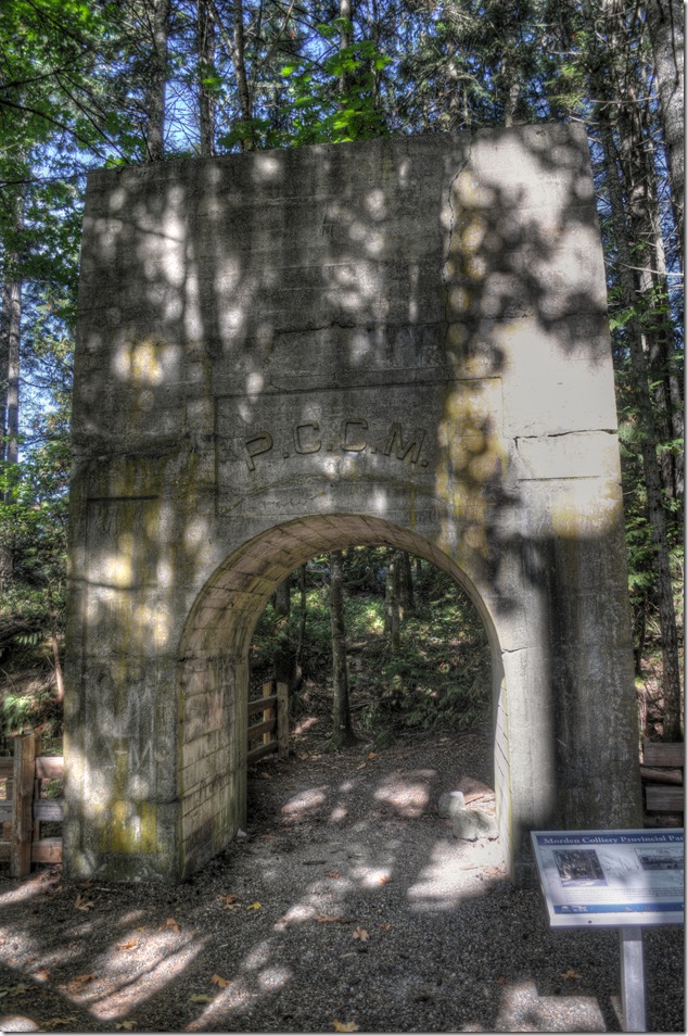
On April 19th 1913 an eight foot wide coal seam was found at a depth of 600 feet, but by the time enough tunnelling was done to reach the first promising coal seam, the mineworkers union declared a strike, effectively ending development underground.. The PCCM was not willing to negotiate a settlement with the miners, and work underground was halted.
Unable to progress underground, work was concentrated on above ground construction using reinforced concrete was to construct the head frame and tipple for the new mine. Cement was shipped from the Vancouver Portland Cement Co. at Tod Inlet near Victoria to the PCCM’s depot at Boat Harbour where the company railway delivered the material directly to the Morden construction site. The seven mile long railway had been completed two years earlier to run from the first PCCM coal mine at South Wellington to the Company’s new shipping depot at Boat Harbour.
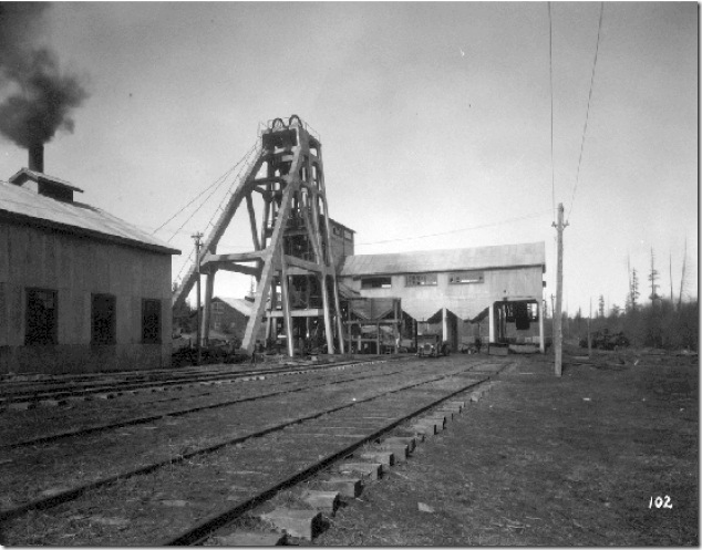
In 1916 construction was complete, tunnelling was done, the strike was over, and the mine was pumped free of water. The eight foot wide coal seam was followed until it was 30 feet wide, and for a period, the mine was operating 50 man shifts, producing over 400 tons of coal per day. Though the original goal was over 1500 tons a day, the mine was found to have too many hard rock deposits mixed in to make this level of extraction possible.
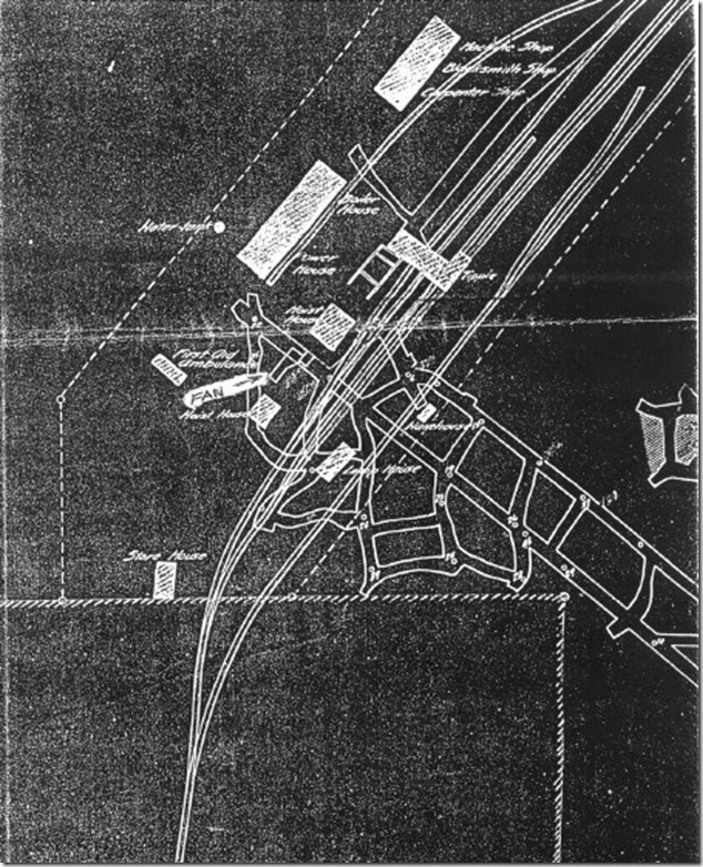
A full 15,000 feet of exploration had occurred by 1920, but the cost of extraction was continuing to climb, and labour stoppages and strikes were ongoing problems for the company. After producing a mere 250,20 tons of coal, shut down in 1921 and allowed to flood when the Company declared bankruptcy.
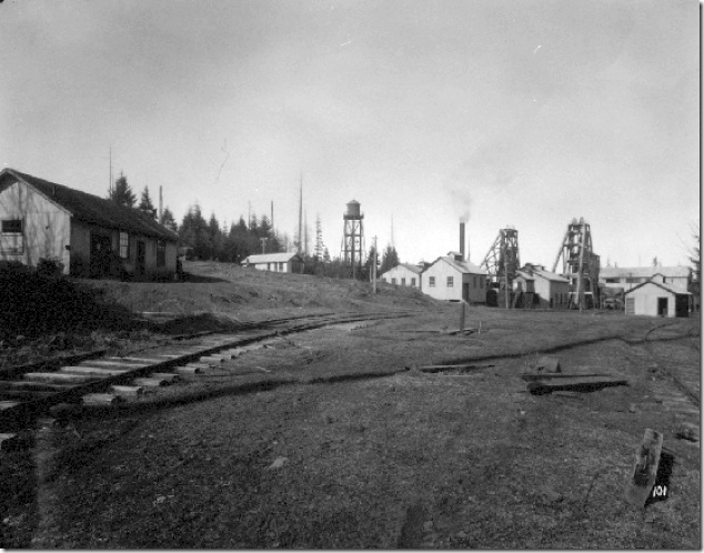
The Morden mine remained closed until 1930, when it was pumped out and re-opened by the Canadian Coal and Company, Ltd. Although there likely remains over 5 million tons of coal on the site, cave-ins and instabilities in the rock were so great that the Morden Mine was abandoned in 1930 after producing less than 31 tons of coal.
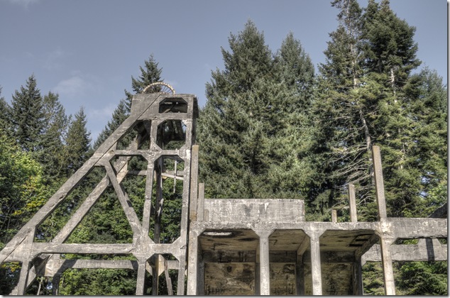
The 75 foot tall reinforced concrete head frame and tipple is one of only two such reinforced concrete coal mine head frame/tipple structures in North America, and is the oldest one of its kind. In 1972, the Morden colliery was recognized as a historic place and the Morden Colliery Historic Provincial Park created.
[fbalbum url=”https://www.facebook.com/media/set/?set=a.269610066496045.1073742050.123247217798998&type=3″ size=”187″]
and now you know…
You may have walked alongside the Puntledge penstock pipeline many times, but have you thought about the nuts and bolts of the pipeline?
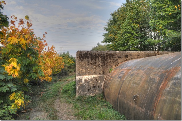
Above, a concrete thrust block – these are normally used where the the pipeline direction or slope changes.
Below, an expansion joint.

and now you know….
1913 The original Comox Lake impoundment dam was constructed at Comox Lake outlet by Wellington Colliery company [later Canadian Collieries (Dunsmuir) Ltd.].
The diversion facilities, as they existed in 1950 prior to redevelopment, were comprised of the present cross-stream weir with two electric gates that controlled flows into a half mile long open wooden flume. The flume led to a 1000 ft. section of brick lined “V” bottom canal – 26 ft. wide by 7 ft. deep in the center. A concrete spillway at the end of the canal diverted excess water back to the river through a short natural channel. Up to 300 cfs. of water for power production passed through a heavy trash rack, down this concrete forbay to a wood stave pipe 2.5 miles long to the power house where two 4700 H.P. reaction turbines generated 7 mw. of 25 cycle power.
This is a bit at odds with what I have seen so far…
Drawing records from the 1950’s show several alternative layouts for fish screens. In anticipation of fish screen construction the power intake section of the dam was constructed with four intakes, although only two were used for power generation. They converge immediately downstream of the dam into a single 3.66 m diameter woodstave penstock. The other two intakes were capped on the downstream side of the dam. Water velocity in the woodstave penstock is 2.64 m/s. The grade of the penstock for the first 1200 m is sufficient only to compensate for hydraulic losses in the pipe and maintain the hydraulic gradient 9.49 m above the crown of the pipe.
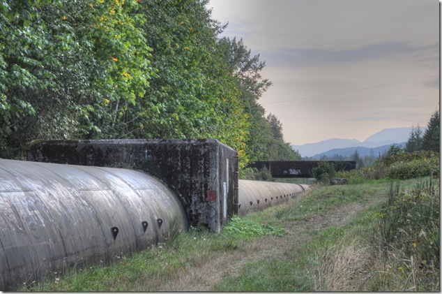
The Duncan Bay Main logging road crossing the Puntledge penstock pipeline
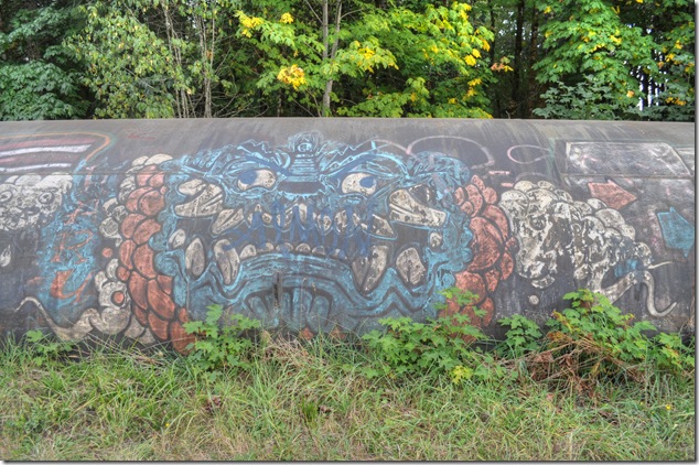
Graffiti on the Puntledge penstock pipeline

Securing Norwegian Pearl (Norwegian Cruise Lines) at James Bay

MS Amsterdam (Holland America Lines) in the background
